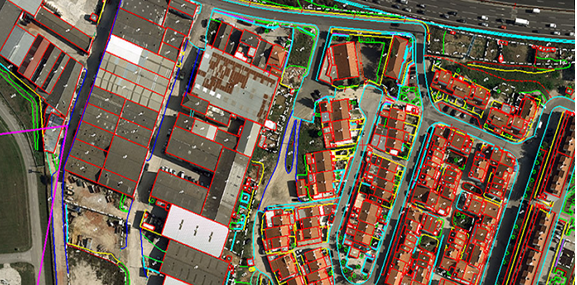
We are capable of capturing Planimetric data from Aerial Photographs and Satellite Stereo images.We are specialized in Large Scale Mapping were the Planimetric details are captured from High Resolution Aerial Photographs with high accuracy generating precision 1-foot contour. Details like, Transportation, Buildings, Structures, Hydrography, Vegetation, Boundaries, Utilities, etc. are captured for comprehensive GIS solutions or for individual projects. Our techniques and detailed project management assure accurate results and consistent deliverables.